File:LocationMauritania.png
Xifaniso lexi axikuriseki kuhundza laha.
LocationMauritania.png (250 × 115 ku anama na leha hi ti phikisele, Vukulu bya fayili: 6 KB, muxaka waMIME: image/png)
Nkomiso
| Description | ||||
| Date | ||||
| Source | Originally created for English Wikipedia by Vardion. | |||
| Author | Vardion | |||
| Permission (Reusing this file) |
|
|||
| Other versions |
|


Matimu ya fayili
thlava eka siku/nkarhi leswaku u vona leswi fayili ayirixiswona hi knarhi walowo
| Siku/Nkarhi | Xifanisonyana | Mpimo | Mutirhisi | Nhlamulo | |
|---|---|---|---|---|---|
| Sweswinyana | 14:29, 4 N'wendzamhala 2007 | | 250 × 115 (6 KB) | Gandal el gris | Reverted to version as of 07:01, 19 November 2007 |
| 11:29, 4 N'wendzamhala 2007 |  | 250 × 115 (5 KB) | Tetouancity | Reverted to version as of 15:01, 14 November 2007 | |
| 07:01, 19 Hukuri 2007 |  | 250 × 115 (6 KB) | Gandal el gris | ||
| 15:01, 14 Hukuri 2007 |  | 250 × 115 (5 KB) | Vispec | Reverted to version as of 12:31, 11 November 2007 | |
| 14:34, 12 Hukuri 2007 |  | 250 × 115 (6 KB) | CHV | Reverted to version as of 18:22, 12 December 2004 | |
| 12:31, 11 Hukuri 2007 |  | 250 × 115 (5 KB) | Vispec | ||
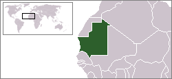
| 18:22, 12 N'wendzamhala 2004 |  | 250 × 115 (6 KB) | EugeneZelenko | Location map for the Mauritania.<br/>Originally created for English Wikipedia by Vardion.<br/>{{PD}}<br/>Category:Country locator maps |
Ntsengo wakutirhisiwa ka fiyili leyi
tluka leri rikhekela eka fayili leyi:
Global file usage
The following other wikis use this file:
- Usage on arc.wikipedia.org
- Usage on ar.wikinews.org
- Usage on az.wiktionary.org
- Usage on bg.wikipedia.org
- Usage on bm.wikipedia.org
- Usage on bpy.wikipedia.org
- Usage on br.wikipedia.org
- Usage on bs.wikipedia.org
- Usage on ca.wikinews.org
- Usage on de.wikinews.org
- Usage on de.wiktionary.org
- Usage on en.wikipedia.org
- Usage on en.wikinews.org
- Usage on en.wikivoyage.org
- Usage on en.wiktionary.org
- Usage on es.wikipedia.org
- Usage on es.wikinews.org
- Usage on fr.wikipedia.org
- Usage on fr.wikinews.org
- Usage on he.wikivoyage.org
- Usage on hr.wiktionary.org
View more global usage of this file.