File:LocationMali.png
Xifaniso lexi axikuriseki kuhundza laha.
LocationMali.png (250 × 115 ku anama na leha hi ti phikisele, Vukulu bya fayili: 6 KB, muxaka waMIME: image/png)
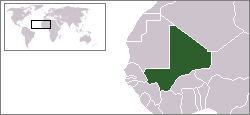
Location map for the Mali.
Originally created for English Wikipedia by Vardion.
| |
This work has been released into the public domain by its author, Vardion, at the Xi Nghezi Wikipediya project. This applies worldwide. In case this is not legally possible: |

|
File:LocationMali.svg is a vector version of this file. It should be used in place of this PNG file when not inferior.
File:LocationMali.png → File:LocationMali.svg
For more information, see Help:SVG. |
 |
Matimu ya fayili
thlava eka siku/nkarhi leswaku u vona leswi fayili ayirixiswona hi knarhi walowo
| Siku/Nkarhi | Xifanisonyana | Mpimo | Mutirhisi | Nhlamulo | |
|---|---|---|---|---|---|
| Sweswinyana | 14:28, 4 N'wendzamhala 2007 | | 250 × 115 (6 KB) | Gandal el gris | Reverted to version as of :, 0 <> |
| 11:29, 4 N'wendzamhala 2007 |  | 250 × 115 (5 KB) | Tetouancity | Reverted to version as of 11:55, 15 November 2007 | |
| 07:02, 19 Hukuri 2007 |  | 250 × 115 (6 KB) | Gandal el gris | ||
| 11:55, 15 Hukuri 2007 |  | 250 × 115 (5 KB) | Vispec | ||
| 18:17, 12 N'wendzamhala 2004 |  | 250 × 115 (6 KB) | EugeneZelenko | Location map for the Mali.<br/>Originally created for English Wikipedia by Vardion.<br/>{{PD}}<br/>Category:Country locator maps |
Ntsengo wakutirhisiwa ka fiyili leyi
tluka leri rikhekela eka fayili leyi:
Global file usage
The following other wikis use this file:
- Usage on arc.wikipedia.org
- Usage on ar.wikipedia.org
- Usage on ar.wikinews.org
- Usage on bg.wikipedia.org
- Usage on bpy.wikipedia.org
- Usage on br.wiktionary.org
- Usage on bs.wikipedia.org
- Usage on ca.wikinews.org
- Usage on ceb.wikipedia.org
- Usage on de.wikinews.org
- Usage on de.wiktionary.org
- Usage on en.wikipedia.org
- Usage on en.wikivoyage.org
- Usage on en.wiktionary.org
- Usage on eo.wikipedia.org
- Usage on eo.wiktionary.org
- Usage on es.wikipedia.org
- Usage on fa.wikinews.org
- Usage on ff.wikipedia.org
- Usage on fr.wikipedia.org
- Usage on he.wikivoyage.org
- Usage on hi.wikivoyage.org
- Usage on hr.wikipedia.org
- Usage on hr.wiktionary.org
- Usage on ig.wikipedia.org
- Usage on incubator.wikimedia.org
- Usage on ja.wikipedia.org
View more global usage of this file.