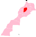
File:Béni Mellal-Khénifra region locator map.svg

Size of this PNG preview of this SVG file: 591 × 599 pixels. Other resolutions: 237 × 240 pixels | 473 × 480 pixels | 757 × 768 pixels | 1,010 × 1,024 pixels | 2,019 × 2,048 pixels | 7,887 × 7,999 pixels.
kuleha na ku anama hixitalo (Fayili ya SVG, vukulu lebyi ringaneke 7,887 × 7,999 hi ti phikisele, vukulu bya fayili: 813 KB)
Matimu ya fayili
thlava eka siku/nkarhi leswaku u vona leswi fayili ayirixiswona hi knarhi walowo
| Siku/Nkarhi | Xifanisonyana | Mpimo | Mutirhisi | Nhlamulo | |
|---|---|---|---|---|---|
| Sweswinyana | 17:00, 29 Ndzhati 2015 |  | 7,887 × 7,999 (813 KB) | Rherrad | User created page with UploadWizard |
Ntsengo wakutirhisiwa ka fiyili leyi
2 matluka lawa makhwekela eka fayili leyi:
Global file usage
The following other wikis use this file:
- Usage on ar.wikipedia.org
- Usage on ary.wikipedia.org
- Usage on ca.wikipedia.org
- Demnat
- Khenifra
- Beni Mellal
- Khouribga
- Província de Khénifra
- Béni Mellal-Khénifra
- Plantilla:Béni Mellal-Khénifra
- Província de Béni Mellal
- Província d'Azilal
- Província de Fquih Ben Salah
- Província de Khouribga
- El Ksiba
- Kasba Tadla
- Zaouiat Cheikh
- Aghbala
- Ait Oum el Bekht
- Boutferda
- Dir El Ksiba
- Foum El Anceur
- Foum Oudi
- Guettaya
- Naour
- Oulad Gnaou
- Oulad M'Barek
- Oulad Nacer
- Oulad Said L'Oued
- Oulad Yaich
- Oulad Youssef
- Semguet
- Sidi Jaber
- Taghzirt
- Tanougha
- Tizi N'Isly
- Fquih Ben Salah
- Oulad Ayad
- Oulad Nemma
- Al Khalfia
- Bni Chegdale
- Bni Oukil
- Bradia
View more global usage of this file.